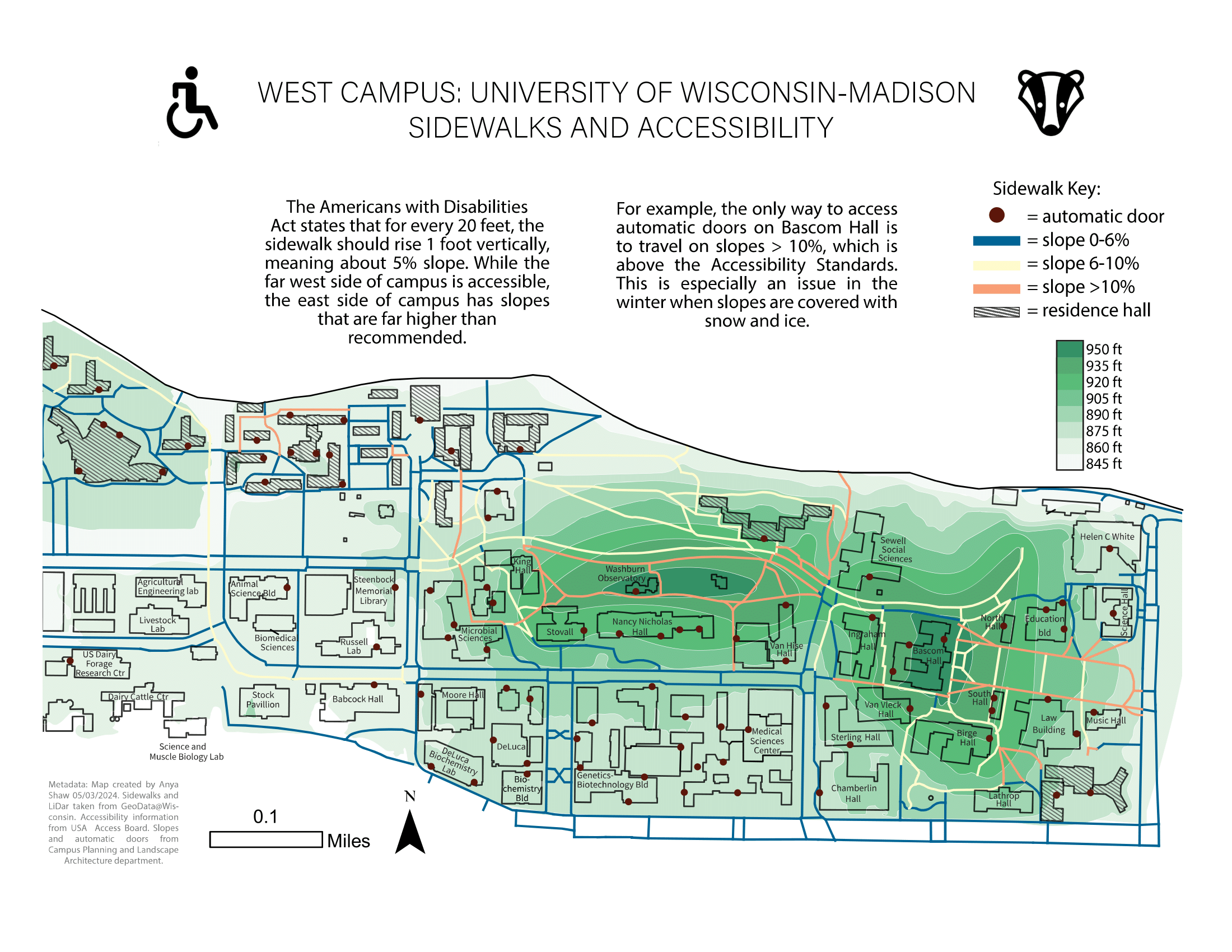
This map was my final project for GEOG370: Introduction To Cartography. I used contour elevation lines in addition to the slopes of the roads to challenge myself to create this final project. My main goal of this map was to convey the accessibility challenges that UW-Madison faces as a land-grant university. It was built on Indigenous land over various burial mounds. Because of this, construction around the hill is very difficult, and infrastructure needs to be built around it. The map was recognized for the Petchenik Award in Spring 2023.